Get on the River
Enjoying the Blackstone
The story of the Blackstone River and Canal can be told from many vantage points. Perhaps the best way to experience its history and beauty is on the waterways – the main stem of the river and its tributaries and the segments of watered canals. Throughout the watershed, the river and canal segments form an interesting and sometimes seamless exploration of the Valley and its industrial heritage where you will discover the dams, canal locks, bridges and other structures that tell the story of "America's Hardest Working River".
The main stem of the river meanders 46 miles from Worcester, Massachusetts to Providence, Rhode Island through urban landscapes, historic villages, farmlands, and forests. The Blackstone drops an average of almost 10 feet per mile, steeper than even the Colorado River through the Grand Canyon. This drop allowed for the development of the many mills you will see along the way. Today, 18 dams are still in place and present paddlers with the challenge of several portages in certain stretches of the river.
Providing access to the river is one of the priorities of the Corridor Commission and plans are underway to improve access points and portages. While present pollution levels allow only recreational fishing in the Blackstone River, there are strong constituencies working to build support for water quality improvement.
There are several ways to get on the river and canal, including:
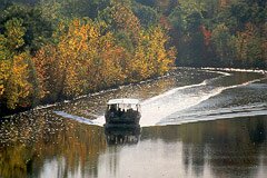
 Take a ride on the Blackstone Valley Explorer - a 49 passenger boat that docks at several different places along the river and offers narrated and special tours of the Blackstone River.
Join the Blackstone River Paddle Club and enjoy an evening on the River with other paddlers.
Find out more about getting involved in the efforts to revitalize the Blackstone Watershed and join one of the many groups in their activities on the river under Zap! the Blackstone.
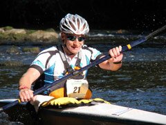
Enjoy a paddle down the river in a canoe or kayak. You can download Paddle Tours by browsing the bar on the right, and take one of the following suggested trips that are based on your skill level and preferences. You can also download a Google Earth file with information on parking for river access, portages, dams, rapids, and other river information.

